|
Image samples (click for larger
version) |
Encapsulated postscript (eps) version and/or caption
|
High resolution jpeg or
tiff (in CMYK color) images (click on link and then copy the image to your hard
disk) |
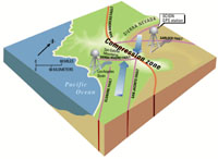 |
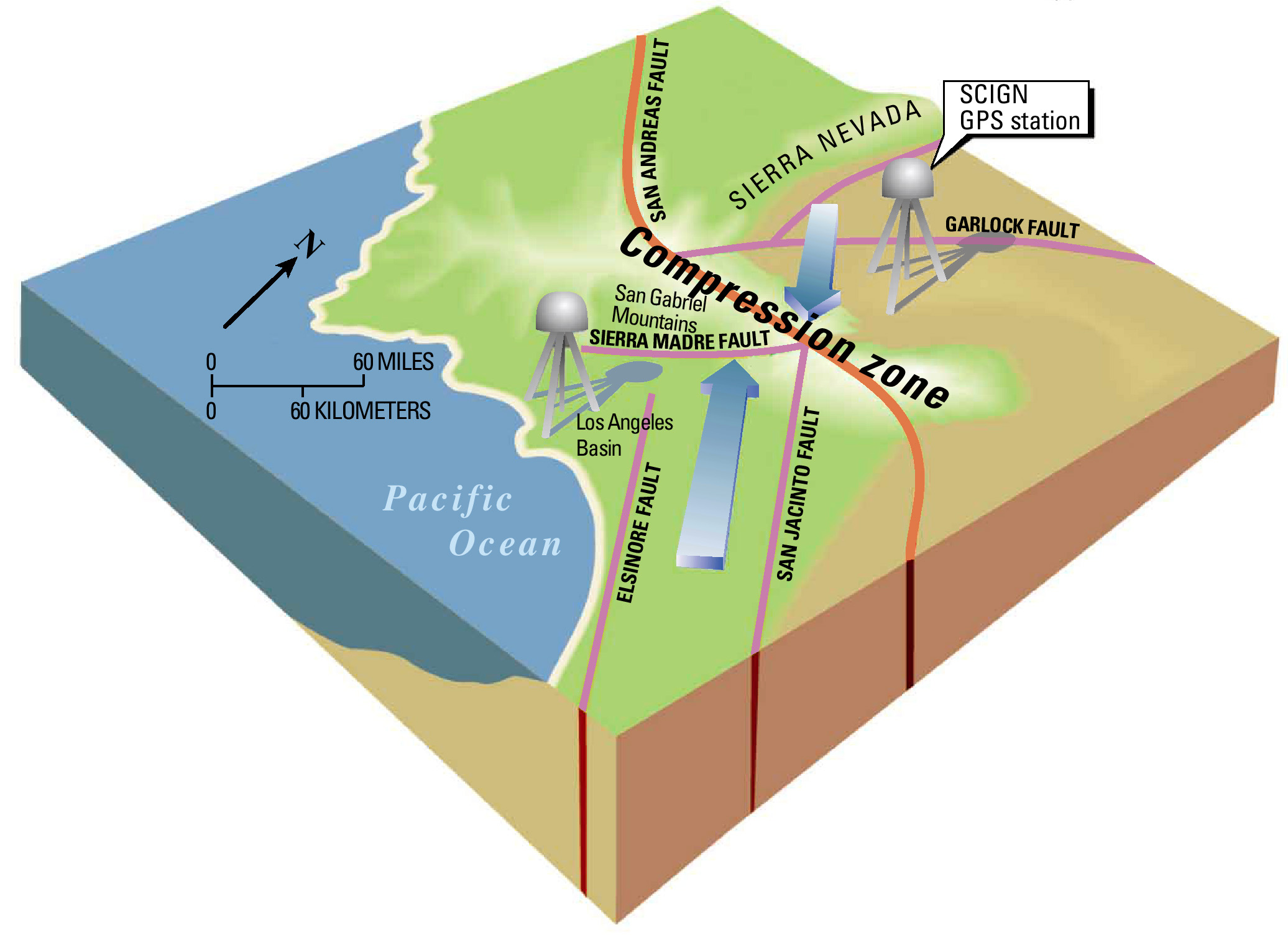
isometric.eps (12.3 MB)
A schematic block model of the tectonic environment of southern
California.
|
isometric.jpg
(400 K) |
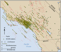 |
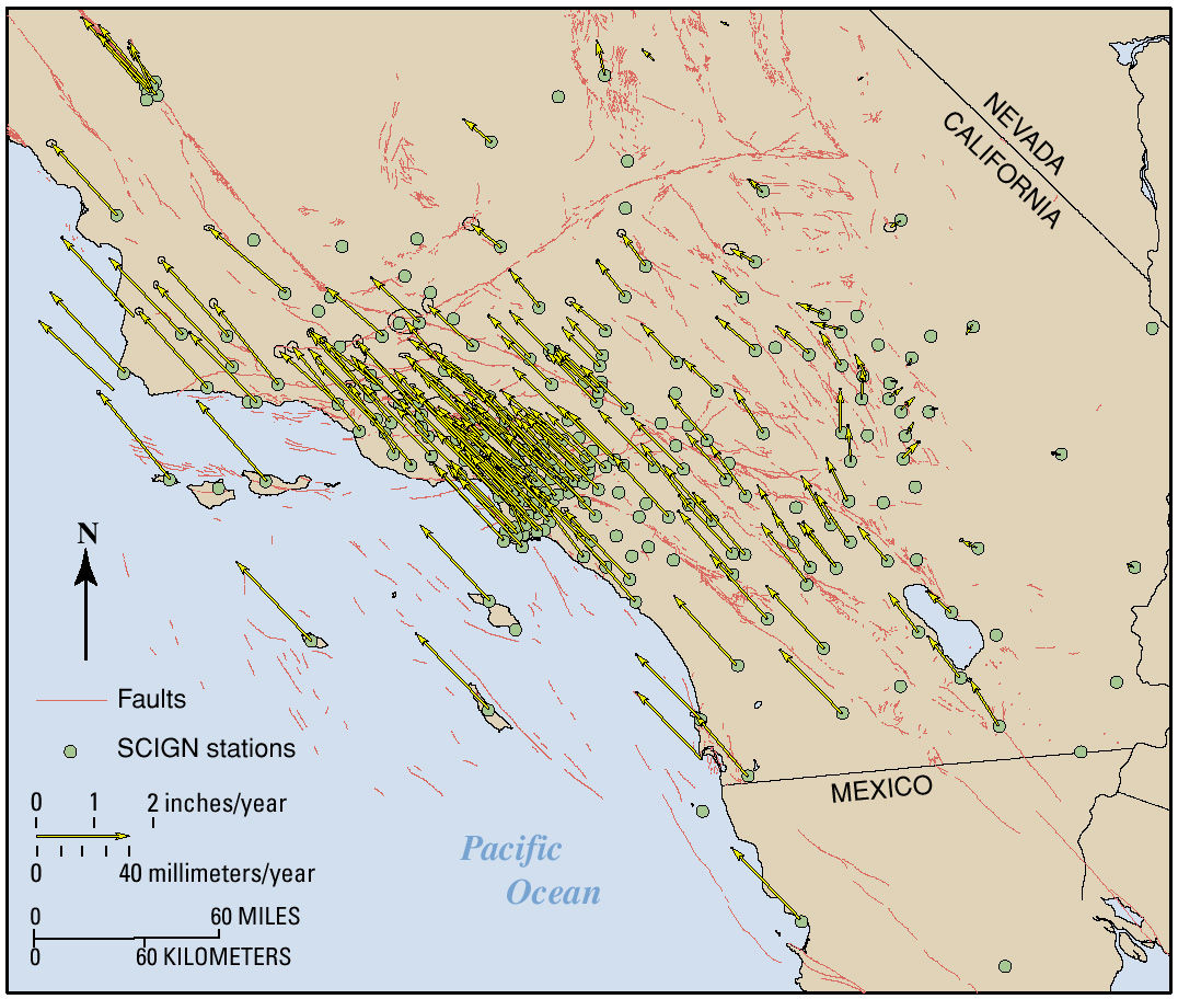
velocitymap.eps (1.1 MB)
A map of the region showing the velocities of SCIGN stations as vectors
with error ellipses.
|
velocitymap.jpg
(456 K) |
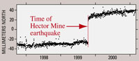 |
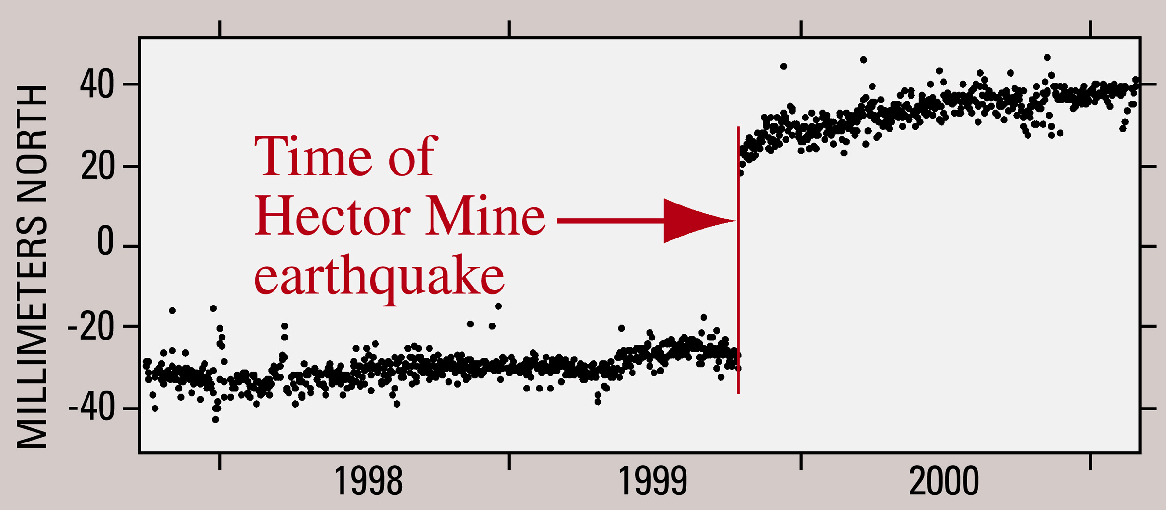
hector.eps (488 K)
A plot of data from a SCIGN station near Palm Springs, showing its north-south
motion before and after the Hector Mine earthquake.
|
hector.jpg
(316 K) |
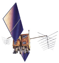 |
An artist's version of one of the satellites that make up the Global
Positioning System.
|
satellite.jpg
(104 K) |
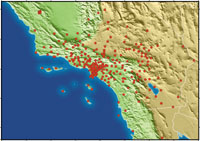 |
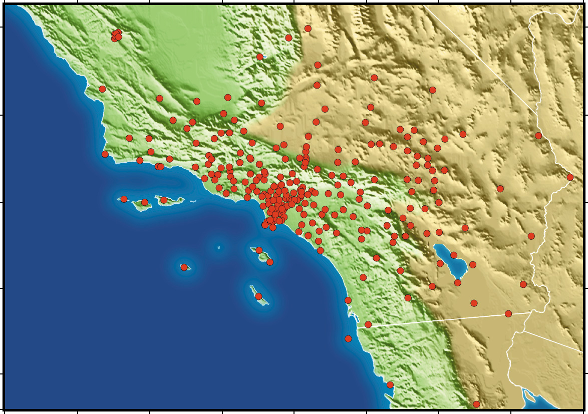
The locations of the SCIGN stations (except for Isla Guadalupe, Mexico (GUAX),
which is far south of the map boundary) are shown as red circles on this
map of the region.
|
stationmap.jpg (408 K)
stationmap.tif (3.7 MB)
|
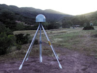 |
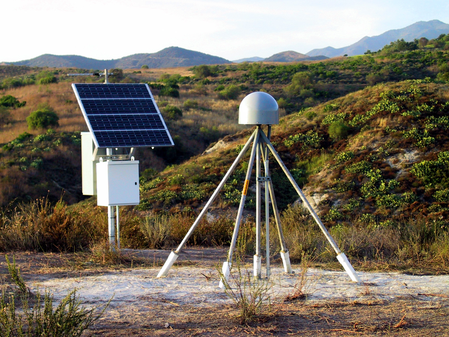
CSST: the SCIGN station at Casitas Station
|
CSST.jpg
(752 K)
CSST.tif (8.6 MB)
|
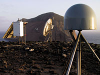 |
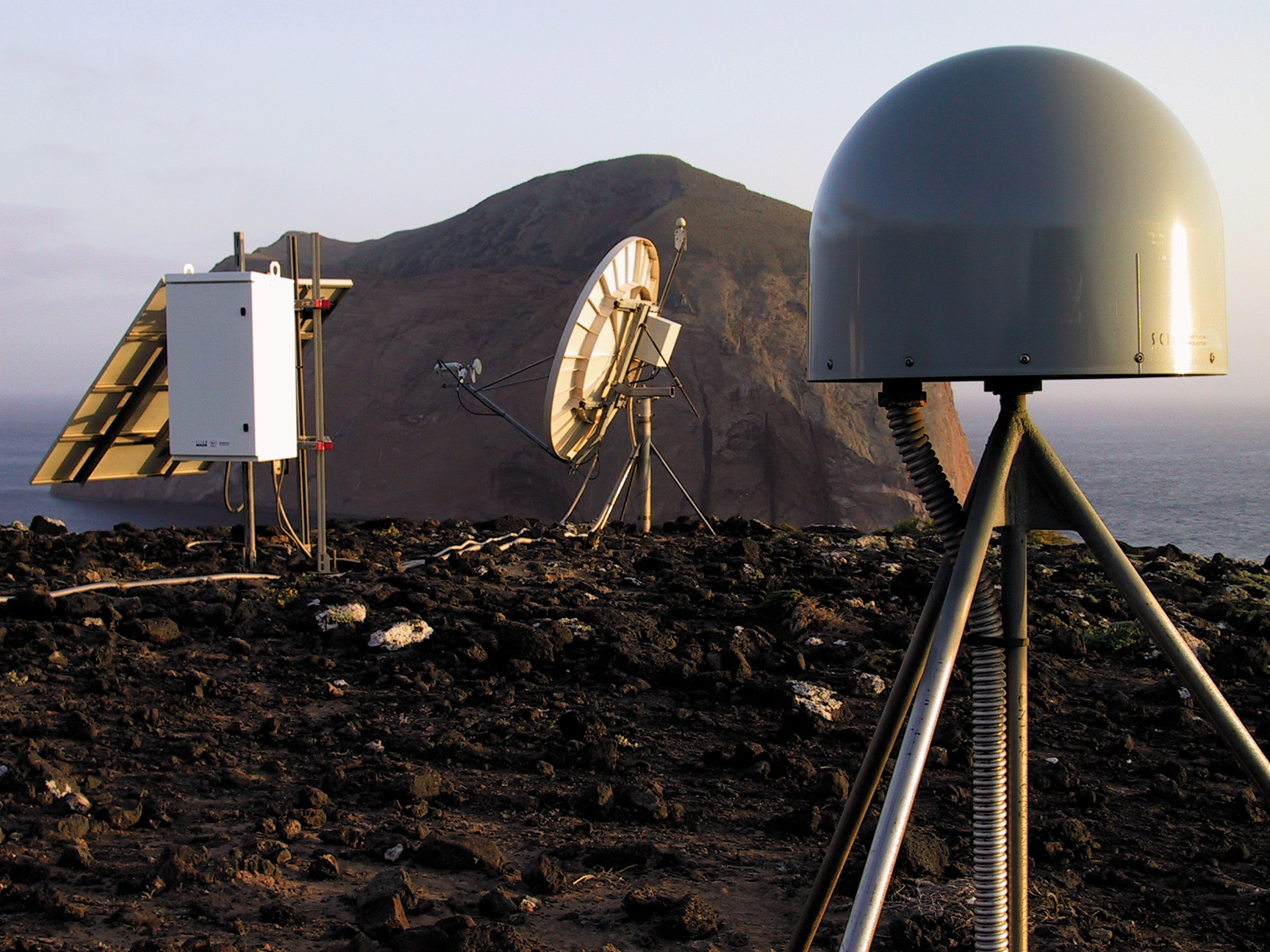
GUAX: the SCIGN station on Isla Guadalupe, Mexico
|
GUAX.jpg
(684 K)
GUAX.tif (8.6 MB)
|
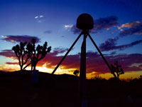 |
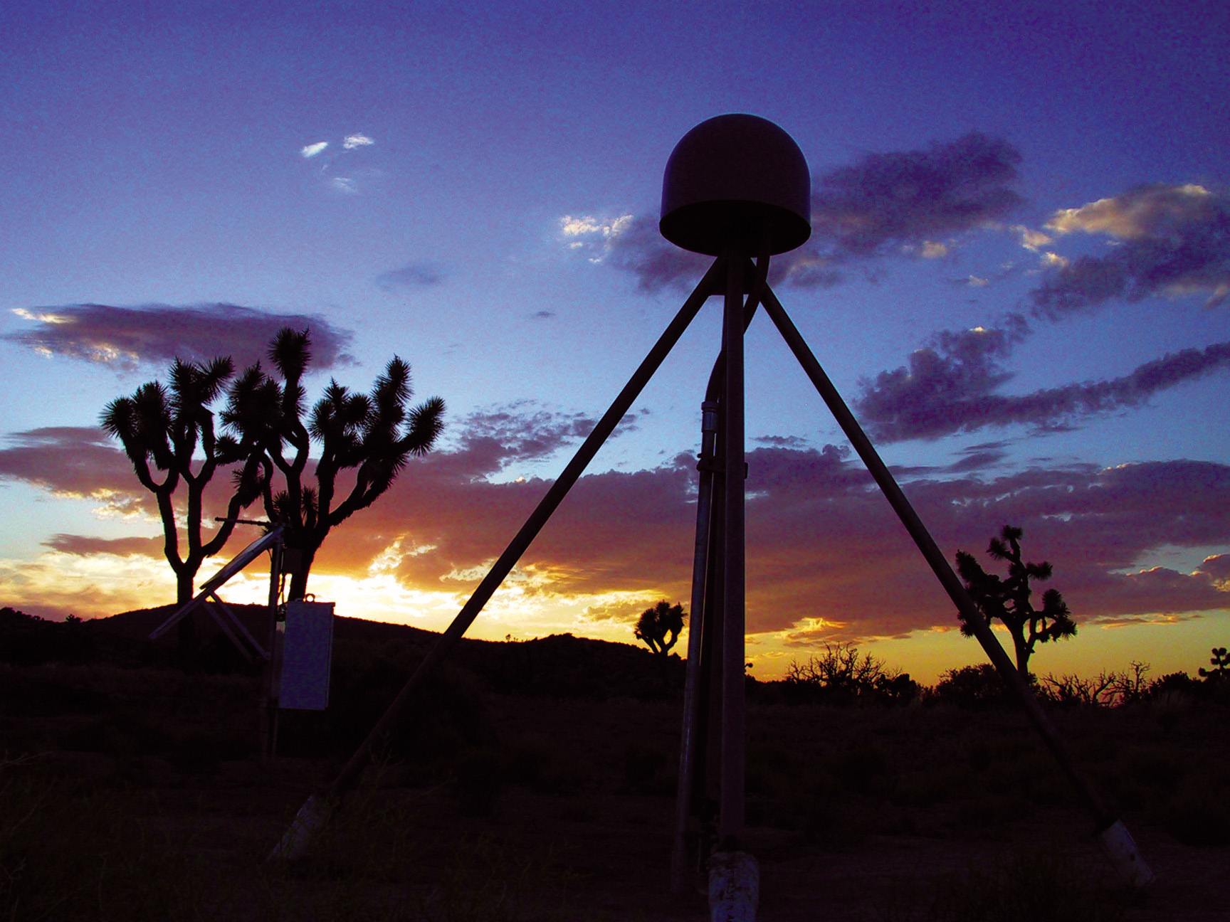
KYVW: Keys View, the 250th SCIGN station, located in Joshua Tree
National Park
|
KYVW.jpg
(459 K)
KYVW.tif (8.6 MB)
|
 |
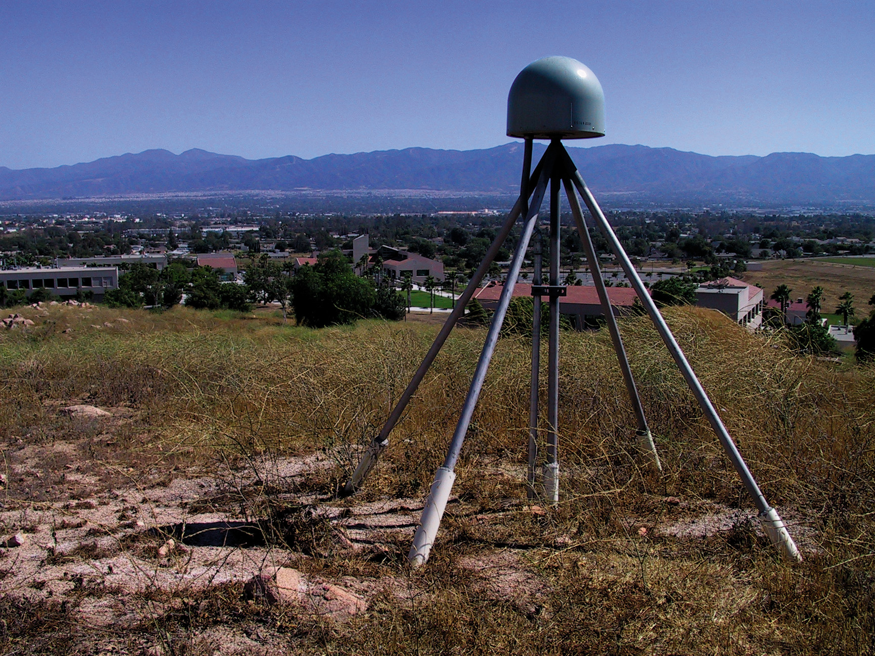
NOCO: the SCIGN station at Norco College
|
NOCO.jpg
(1 MB)
NOCO.tif (8.6 MB)
|
 |
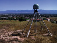
PKRD: the Packard SCIGN station, located in Elysian Park, above downtown L.A.
|
PKRD.jpg
(580 K)
PKRD.tif (8.6 MB)
|
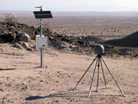 |
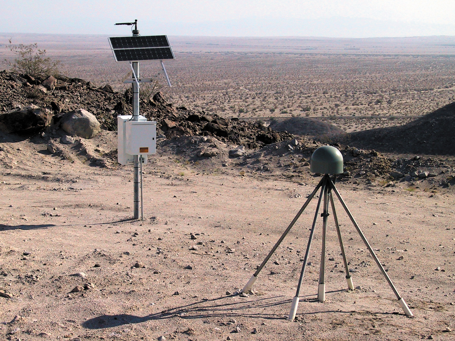
USGC: the SCIGN station located near the U.S. Gypsum Company
|
USGC.jpg
(1 MB)
USGC.tif (8.6 MB)
|
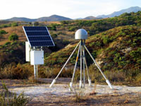 |
WHYT: the SCIGN station at Whiting Park
|
WHYT.jpg
(912 K)
WHYT.tif (8.6 MB)
|